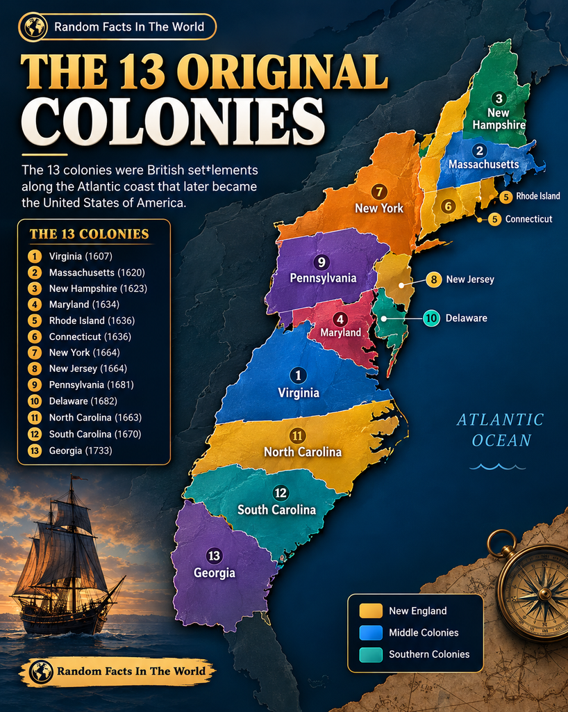
In 1775, the year the American Revolutionary War began, Britain’s mainland American colonies were far more diverse than a simple map of English settlements might suggest. English-speaking communities lived alongside German-speaking farmers, Dutch descendants, Scots-Irish migrants, French Huguenots, Africans, and many other groups.
The historical map Predominant Immigrant Groups 1775 illustrates how these communities were distributed across parts of eastern North America. It highlights settlement patterns from New England to Georgia and identifies major colonial towns and cities.
Yet the map tells only part of the story. Migration occurred for many reasons, including religious persecution, economic opportunity, family connections, and the search for land. For Africans brought across the Atlantic through enslavement, migration was often forced and accompanied by profound violence. Indigenous nations, meanwhile, had longstanding histories and communities throughout the region.
Understanding these differences helps explain the complex society that existed on the eve of American independence.
What Did Colonial America Look Like in 1775?
The mainland British colonies had a population of approximately 2.5 million people around the beginning of the Revolution, including about 500,000 Black people, most of whom were enslaved. The exact estimates vary by source and reference date. <Cite refs={[“turn446929search0″,”turn446929search7″,”turn446929search10”]}/>
English settlers and their descendants formed the largest European-origin population. However, substantial communities had roots in other parts of Europe and the Atlantic world.
The map emphasizes this regional diversity. It shows areas associated with English settlers in parts of New England and the South, Dutch settlement around New York, German and Scots-Irish communities in the interior, and French Huguenot settlements in parts of the southern colonies.
These patterns developed over generations. They were influenced by land availability, religious institutions, trade, colonial policies, and established migration routes.
The English: The Largest European-Origin Community
English settlers established many of the earliest permanent English colonies along the Atlantic coast. By 1775, their descendants constituted the largest European-origin group in the mainland colonies.
English settlement was especially influential in New England, the Chesapeake region, and parts of the southern colonies. English legal traditions, language, political institutions, and cultural practices helped shape colonial society.
However, being of English descent did not mean everyone shared the same religious beliefs, economic interests, or political loyalties. On the eve of the Revolution, colonists disagreed over taxation, representation, imperial authority, and the future relationship with Britain.
The Scots-Irish and Highland Scots
The terms Scots-Irish and Highland Scots refer to different communities.
Scots-Irish settlers were largely descended from Scottish Protestants who had settled in Ulster, in northern Ireland, before many migrated to North America during the eighteenth century. Economic pressures, religious circumstances, and the desire for land contributed to migration.
Many Scots-Irish families settled in Pennsylvania before moving into the interior and backcountry of Virginia and the Carolinas. Their settlement patterns helped expand European colonial occupation westward into areas already inhabited and used by Indigenous peoples. <Cite refs={[“turn446929search0″,”turn446929search9”]}/>
Highland Scots came directly from Scotland’s Highlands and islands or from communities associated with that region. Their migration had its own chronology and motivations, so they should not be treated as interchangeable with the Scots-Irish.
German-Speaking Settlers and Pennsylvania’s Diversity
German-speaking immigrants arrived from various German states and neighboring regions, including areas associated with Switzerland. They did not all share one religion, political identity, or economic background.
Pennsylvania became an important destination because of its agricultural opportunities, established communities, and religious diversity. German-speaking settlers included Lutheran and Reformed Protestants, Mennonites, and other religious groups.
Many established farms and communities where German languages and traditions continued across generations. Their presence contributed to the distinctive cultural landscape of the middle colonies. <Cite refs={[“turn446929search2″,”turn446929search24”]}/>
The map’s broad regional colors simplify these communities. In reality, settlement boundaries were rarely as clear as a colored region suggests, and neighboring populations frequently interacted through commerce, marriage, religious life, and local government.
Dutch Settlers and New York’s Colonial Roots
The Dutch established New Netherland in the seventeenth century, including the settlement that became New Amsterdam and later New York.
Although England took control of the colony in 1664, Dutch-descended communities remained influential in the Hudson Valley and surrounding areas. Dutch names, religious institutions, farming traditions, and commercial connections continued after English rule began.
New York’s location also made it an important port connecting inland communities with Atlantic trade. By 1775, the city and its surrounding region were home to people of several European backgrounds, as well as free and enslaved Black residents.
The map’s Dutch settlement areas therefore reflect an older colonial history that continued to influence the region long after formal Dutch political control ended.
French Huguenots and Other European Communities
French Huguenots were French Protestants, many of whom faced religious persecution following conflicts between Catholics and Protestants in France.
Some Huguenots settled in the American colonies, including communities in the South. In South Carolina, French Protestant settlers became part of the broader society around Charleston and the surrounding Lowcountry. <Cite refs={[“turn446929search11″,”turn446929search8”]}/>
The map also identifies Swedes, Welsh people, and Jews. These groups differed in size, settlement history, religious traditions, and economic circumstances.
Some communities were concentrated in particular towns or districts; others became integrated into larger colonial populations. A map showing predominant settlement areas cannot capture the full complexity of these overlapping identities.
Africans and the Reality of Enslavement
One of the most important parts of colonial America’s demographic history is also one of its most painful.
Hundreds of thousands of Africans and their descendants lived in the colonies by 1775. Many had been forcibly transported across the Atlantic and sold into slavery. Their labor supported plantation agriculture and other parts of the colonial economy, particularly in the South.
Enslaved populations were especially significant in Virginia, Maryland, the Carolinas, and Georgia. The plantation economies of these regions depended heavily on enslaved labor, although slavery also existed in northern colonies.
Not every Black person was enslaved, and free Black communities existed throughout colonial America. Nevertheless, the majority of Black people in the colonies were held in bondage. <Cite refs={[“turn446929search10″,”turn446929search12”]}/>
Describing Africans simply as another immigrant group risks obscuring the coercion, family separation, violence, and denial of freedom that characterized the transatlantic slave trade. Their experiences were fundamentally different from those of European settlers who migrated voluntarily.
What the Map Leaves Out
The map is useful for illustrating broad patterns, but it should not be mistaken for a complete account of colonial population history.
First, settlement regions overlapped. Families of different backgrounds lived near one another, moved between colonies, and formed communities that cannot be neatly divided by color.
Second, the map does not provide a detailed population count for each group. A large colored area does not necessarily mean that the group represented there formed a majority of the population.
Third, Indigenous nations are not adequately represented in the map’s immigrant-group categories. Native peoples had lived across these lands for thousands of years and maintained their own political systems, economies, cultures, and territories. Colonial expansion displaced communities, contested Indigenous sovereignty, and transformed existing relationships across the region.
These omissions matter because colonial America was not an empty landscape waiting to be settled. Its demographic history involved both migration and the expansion of colonial power over Indigenous lands.
Frequently Asked Questions
1. How many people lived in the American colonies in 1775?
Historians commonly estimate the population at approximately 2.5 million, including roughly 500,000 Black people, most of whom were enslaved. These are historical estimates rather than a modern census count. <Cite refs={[“turn446929search7″,”turn446929search10”]}/>
2. Which European-origin group was largest?
People of English descent formed the largest European-origin group in the mainland British colonies. However, the population also included significant Scots-Irish, German, Scottish, Dutch, and other communities.
3. Why did so many German-speaking settlers go to Pennsylvania?
Pennsylvania offered agricultural opportunities and established communities, while its religious diversity attracted several groups seeking places to settle and practice their beliefs.
4. Were Scots-Irish and Highland Scots the same group?
No. Scots-Irish settlers were largely descended from Scots who had settled in Ulster, while Highland Scots came from Scotland’s Highland regions and associated communities.
5. Did the map show everyone living in colonial America?
No. It simplifies settlement patterns and does not fully represent overlapping communities, individual population numbers, or Indigenous nations. It should be used as an introduction to the subject rather than a complete demographic record.
Conclusion
The settlement map of 1775 reveals a colonial society shaped by many different communities and historical experiences. English settlement formed the dominant European-origin presence, while Scots-Irish, German-speaking, Dutch, French Huguenot, and other communities contributed to the cultural landscape.
At the same time, the map must be read alongside the histories of Indigenous nations and enslaved Africans, whose experiences cannot be reduced to ordinary immigration.
As the American Revolution began, these populations shared a continent but did not share equal rights, opportunities, or political power. Understanding who lived where—and how those settlement patterns developed—offers a deeper view of the society that preceded the creation of the United States.
Sources for further reading
- Library of Congress, Exploration and Settlement: https://www.loc.gov/exhibits/british/brit-1.html
- Digital History, Ethnic Division of the Colonial Population, 1775: https://www.digitalhistory.uh.edu/disp_textbook_print.cfm?psid=3793&smtid=11
- U.S. Census Bureau, Population of the Colonies in the 1770s: https://www.census.gov/library/stories/2023/12/boston-tea-party.html
- Library of Congress, Racial, Ethnic, and Religious Minorities in the Revolutionary War: https://guides.loc.gov/racial-ethnic-and-religious-minorities-in-the-revolutionary-war